Never have we had so many tools to plan a walk or bicycle ride. Now if we could just get the weekend weather to cooperate.
Your best bet for a weekend walk or ride is Saturday (63 degrees, partly cloudy predicted) with Sunday less desirable (54 degrees, 80 percent chance of rain).
If you’re planning a walk, you might want to check out the Northeast Seattle Trails map, which lists parks, bathrooms and other important sites. (Incidentally, Wedgwood is rated the 56th most walkable neighborhood in Seattle by Walk Score. Does that seem low to anybody? View Ridge comes in at 72 — a small price to pay for having all those hills and being able to look down on Lake Washington.)
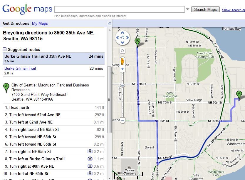
If you’re planning a bike ride, you might want to try Google’s new mapping feature. Just go to Google maps, and click “Directions” and then select “bicycle” for your mode of travel (you also can choose “by public transit” or “walking”). Those smart guys at Google apparently take into account the best bike routes to help you avoid hills and high-traffic streets.
For instance, the map above shows their recommended route for getting from Magnuson Park to the center of Wedgwood without plowing up NE 70th Street, one of the most difficult bike rides in the city with an elevation climb of 370 feet in eight blocks. Or just knock yourself out and head up NE 70th Street for a little training ride — after all, awaiting less than 20 blocks way is Top Pot Doughnuts.


